Indo Islamic Heritage


Rail: The nearest rail hub is Guntur Railway Station, approximately 2–4 km away, offering frequent connections across Andhra Pradesh and beyond. Bus: The Guntur APSRTC Bus Complex lies roughly 3–5 km from the area, with regular APSRTC and private bus services to major cities such as Vijayawada, Hyderabad, and Tirupati. Air: The nearest airport is Vijayawada International Airport, about 80–90 km from Guntur, providing domestic flight connectivity.
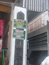
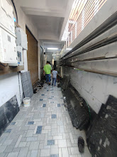
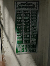
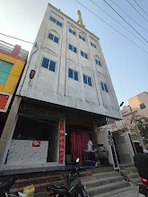
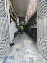
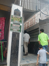
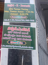
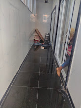
Masjid-E-Zeenat, located at 52-3-269, 3rd Lane, Gunturvari Thota (Pottur Vari Thota), Guntur, Andhra Pradesh 522003, is a neighborhood mosque serving the Muslim residents of Gunturvari Thota and the surrounding lanes. Nestled within a mixed residential and local-commerce neighborhood, the mosque provides a dedicated place for the five daily prayers (ṣalāh), Friday (Jumuʿah) congregational prayer, and major Islamic observances such as Ramadan Taraweeh and Eid-ul-Fitr/Eid-ul-Adha gatherings. In addition to its role as a place of worship, Masjid-E-Zeenat plays a community role—facilitating Qur’anic recitation, informal religious instruction (taʿlīm), and neighborhood fellowship that brings families together and strengthens social cohesion within this part of Guntur city. The mosque’s presence reflects the broader pattern in Guntur of embedding small to medium neighborhood mosques into residential grids so that spiritual needs are within easy reach for daily worshippers. Gunturvari Thota and Pottur Vari Thota are traditional urban localities characterized by closely arranged residential streets, small shops, and community institutions. Mosques like Masjid-E-Zeenat often serve as focal points during significant periods of the Islamic calendar, supporting collective prayers and shared celebrations that enhance community spirit.
Year of Built: Not Known
Address: 52-3-269, 3rd Ln, Gunturvari Thota, Pottur Vari Thota, Guntur, Andhra Pradesh 522003
Country: India
State: Andhra Pradesh
District: Guntur
Pincode: 522003
Longitude: 80.4430° E
Latitude: 16.2952° N