Indo Islamic Heritage


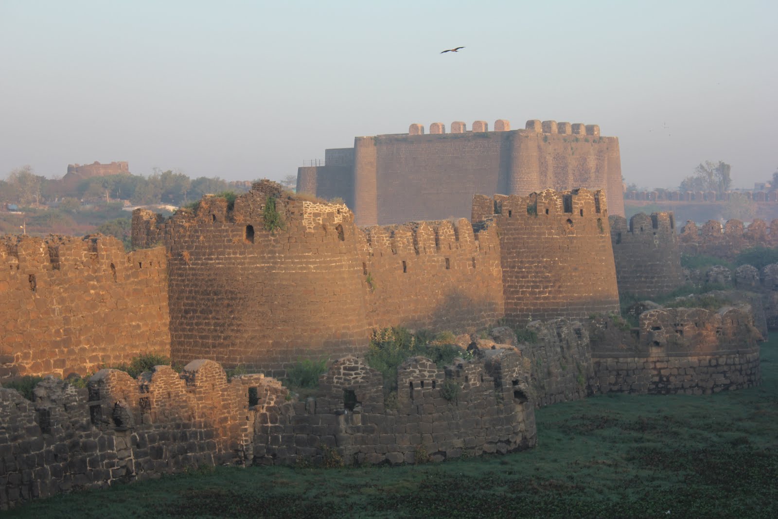
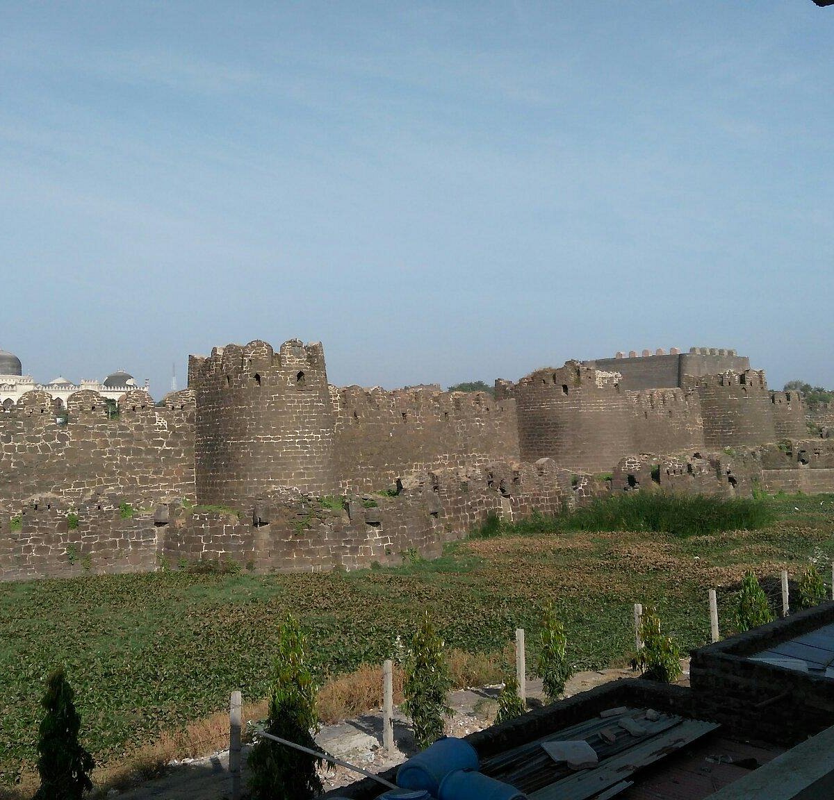
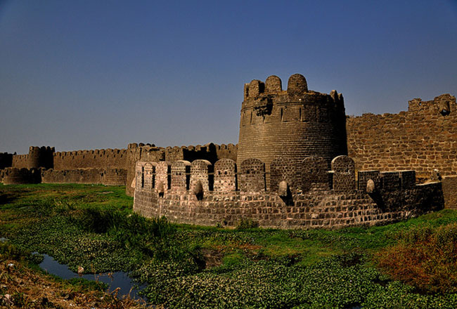
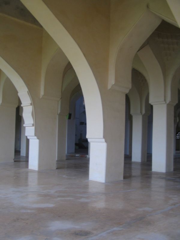
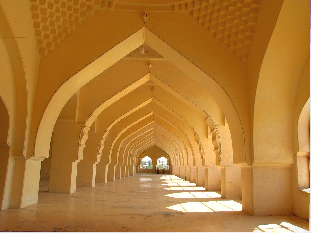
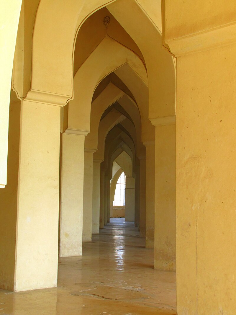
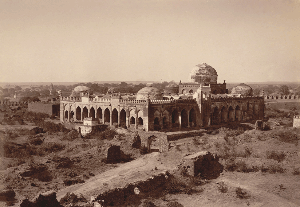
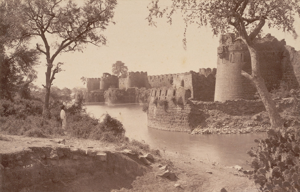
The Gulbarga Fort, located in Kalaburagi (formerly Gulbarga) in the Kalaburagi district of North Karnataka, has a rich historical background. Originally built by the Hindu monarch Raja Gulchand, the fort was later expanded in 1347 by Ala-ud-Din Bahman Shah after he established the Bahmani Sultanate, breaking away from the Delhi Sultanate. The fort features a blend of Hindu and Islamic architectural styles, with its massive walls, gates, and watchtowers. One of the most notable features of the fort is the presence of an ancient mosque within its precincts, showcasing the fort's evolution over time. The Bahmani Sultanate strengthened the fort as part of its capital's defenses, making it an important strategic and administrative hub during the medieval period.
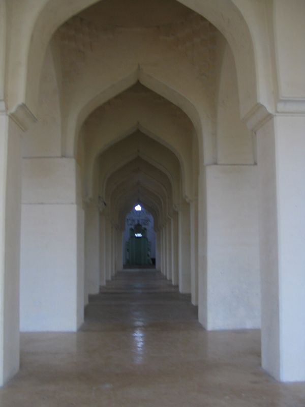
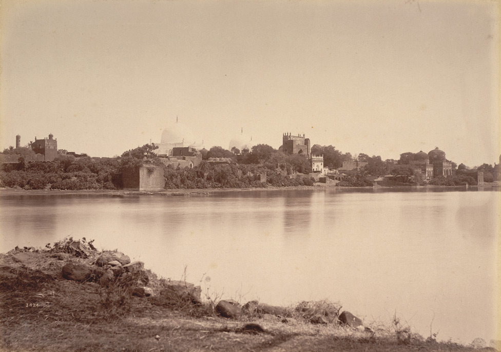
The history of Gulbarga, located in the northeastern part of Karnataka, traces back to the 6th century when it was part of the Rashtrakuta Empire. Over the centuries, the region saw control shift between several powerful dynasties, including the Chalukyas, Kalachuris, Yadavas, Hoysalas, and the Kakatiya dynasty. The Kakatiyas held control over parts of the region until the early 14th century, when the Delhi Sultanate annexed the northern Deccan, including Gulbarga. In 1347, the Bahmani Sultanate was established after the revolt of Muslim officers under Muhammad bin Tughluq. Zafar Khan, later known as Alauddin Hasan Bahman Shah, made Gulbarga his capital, renaming it 'Ahsenabad.' The fort in Gulbarga became a central symbol of the Bahmani Empire, and the city remained its capital until 1424 when it was moved to Bidar. The Bahmani Sultanate brought a significant cultural shift to the region, incorporating Persian, Iraqi, Iranian, and Central Asian influences while integrating Hindu traditions. Following the decline of the Bahmani Sultanate, the Vijayanagara Empire razed the fort, but it was later rebuilt by Yusuf Adil Shah of the Sultanate of Bijapur. In the 17th century, the fort was captured by the Mughal Empire under Aurangzeb. The area became part of Hyderabad State after the Mughal Empire's decline, and in 1948, it was annexed into the Dominion of India. After the reorganization of states in 1956, Gulbarga became part of Karnataka. Gulbarga's geography features a dry, arid climate with black cotton soil, and it is drained by the Krishna and Bhima rivers. The region experiences limited rainfall and temperatures that can soar as high as 45?C in summer and dip to 5?C in winter. Architectural Significance: The Bahmani Sultanate's architectural influence is evident in the structures of Gulbarga, particularly the fort, mosques, and tombs. The Gulbarga Fort, covering approximately 57 acres, is known for its Indo-Persian architectural style, with impressive fortifications, a moat, and 15 towers mounted with guns. The fort's design reflects the military architecture of the Deccan region, heavily influenced by Persian styles. The Jama Masjid, one of the earliest mosques in South India, is renowned for its symmetrical design and Persian influences. Built with five large domes, it stands as a testament to the architectural splendor of the Bahmani Sultanate. The tomb of the Sufi saint Bande Nawaz, constructed in the Indo-Saracenic style, is another significant monument. The dargah (shrine) complex houses the saint?s tomb and features a blend of Turkish and Persian influences in its architecture and paintings. These historical sites, along with the region's rich history, reflect the diverse cultural and architectural heritage of Gulbarga, making it an important center of medieval Deccan history.
Year of Built: 13th Century
Address: Gulbarga Fort, Halbarga, Brhampur, Kalaburagi, Karnataka
Country: India
State: Karnataka
District: Gulbarga
Pincode: 585101
Longitude: 76.8310
Latitude: 17.3414